Kīlauea may not be erupting, but increased earthquake activity over the weekend has promoted Hawaiian Volcano Observatory to increase alert levels and Hawaiʻi Volcanoes National Park closing certain areas in the park.
HVO raised the Volcano Alert Level for ground-based hazards from an “advisory” to a “watch.” The aviation color code was also raised from “yellow” to “orange.”
View this post on Instagram
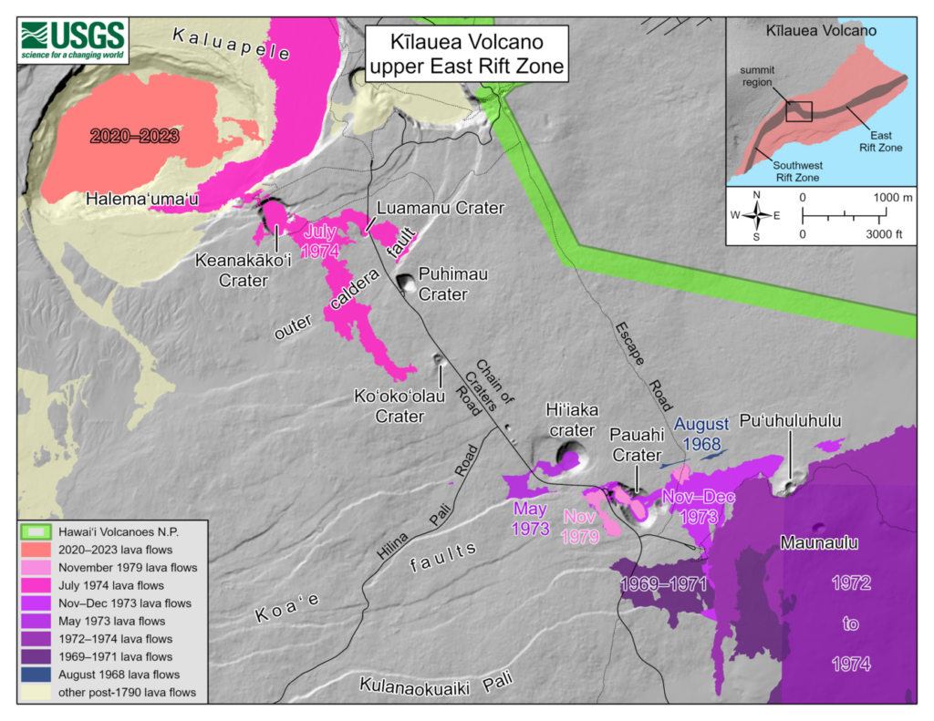
Earthquake activity is centered near Pauahi Crater. The situation is rapidly evolving, HVO reports, but it’s not possible to say with certainty that this increased earthquake activity will lead to an eruption.
The last time Kīlauea, Hawaiʻi’s most active volcano, erupted was on June 3; it paused 12 hours later.
Source: Hawaiian Volcano Observatory
The U.S. Geological Survey said earthquakes and ground deformation at Kīlauea’s upper East Rift Zone began at approximately 3:30 a.m. Tuesday. Scientists said this was an indication that magma was moving beneath the surface.
Earthquakes and ground deformation rates began to suddenly increase more after 11a.m. Monday, prompting the National Park Service to close several areas in the national park in case an eruption does occur.
About 40 earthquakes have been detected, the largest of which was a magnitude-3.1. USGS said earthquake activity is centered near Pauahi Crater. (See map above.)
If you’re planning to visit the national park today, these areas are closed:
- Chain of Craters Road from the intersection at Devastation parking to the coast
- Kulanaokuaiki Campground
- Crater Rim Trail south of Nāhuku lava tube
- Coastal backcountry areas and Napau sites. All new backcountry permits for those areas are canceled.
- Escape Road from Nahuku to Maunaulu
Check the park website for closures and hazards alerts: nps.gov/havo