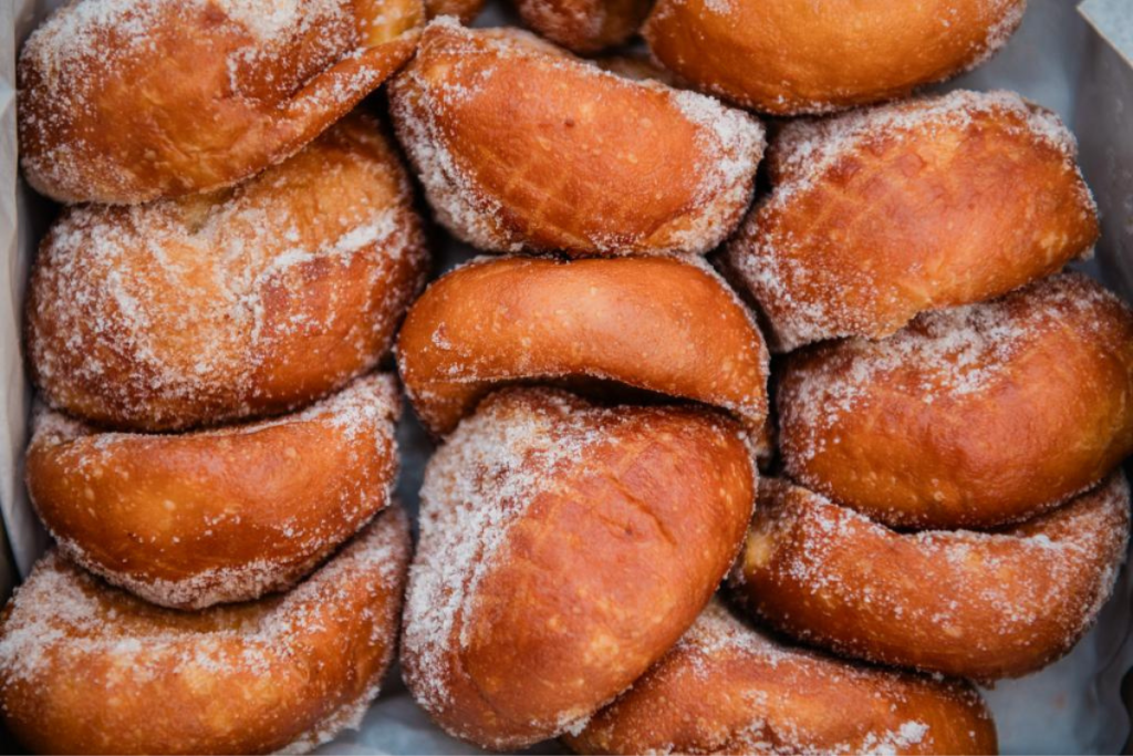
Across the Islands, you can find local bakeries making malasadas. The deep-fried, sugar-dusted doughnut is best served warm to enjoy its crisp exterior and soft, fluffy center.
Like many iconic dishes in Hawaiʻi, the origins can be traced back to the Islands’ plantation days.
READ MORE: So, What’s the Big Deal with Malasadas?
Malasadas arrived in Hawaiʻi with Portuguese plantation laborers from the Madeira and Azores islands.
But we can all thank Leonard Rego for helping popularize the doughnut. In 1952, he opened Leonard’s Bakery on Oʻahu. Shortly after opening bakery, he made malasadas for Fat Tuesday, the day before Lent. Rego didn’t plan on keeping malasadas on the menu, but they were such a hit that he decided to continue selling them. Today, malasadas remain at the heart of Leonard’s Bakery.
From Līhuʻe on Kauaʻi to Punaluʻu on Hawaiʻi Island, you can find top-notch malasadas across Hawaiʻi. These are the shops our readers love most.
1. Leonard’s Bakery, Oʻahu
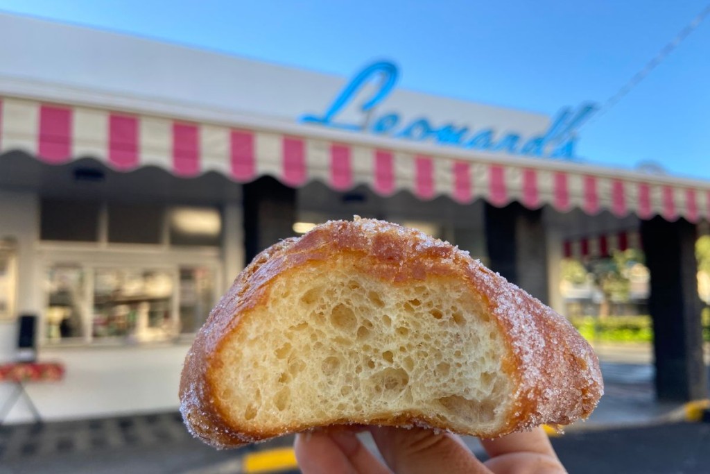
Photo: Catherine Toth Fox
Year after year, Leonard’s Bakery ranks among the best spots for malasadas. After all, the beloved institution on Oʻahu played a major role in popularizing the pastry in the Islands. The most popular item is the classic malasada: a golden pastry covered in a generous coat of sugar. You can also order malasadas dusted in cinnamon sugar or li hing powder, as well as malasada puffs filled with haupia, chocolate, macadamia nut or guava.
READ MORE: For the Family Behind Leonard’s Bakery, Making Malasadas is a Sweet Labor of Love
2. Kauaʻi Bakery, Kauaʻi
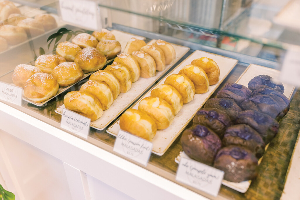
Photo: Mami Wycoff
It’s easy to keep eating malasada after malasada from Kauaʻi Bakery because these pastries are so light and fluffy. Located in Kukui Grove Center, the bakery is a local favorite for its cinnamon rolls, but its malasadas are among its bestsellers, too. You can pick up a classic malasada or try one filled with ube, custard or haupia.
READ MORE: Kauaʻi Bakery is Still Our Favorite Sweet Spot
3. Punaluʻu Bake Shop, Hawaiʻi Island
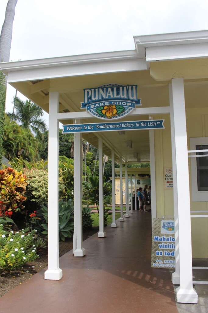
Photo: Catherine Toth Fox
Punaluʻu Bake Shop is considered the southernmost bakery in the U.S. At this charming bakery, you can order a classic malasada along with flavored varieties that include taro, guava and mango. You can also enjoy glazed malasadas or pastries stuffed with sweet fillings.
4. T. Komoda Store & Bakery, Maui
In the heart of Makawao Town sits T. Komoda Store & Bakery. Opened in 1916, the historic bakery is among the oldest family-run businesses on Maui. Famous for its cream puffs and doughnut sticks, Komoda’s malasadas are just as noteworthy. Fried to perfection, these soft, pillowy pastries are also served on a stick and always hit the spot.
5. Pipeline Bake Shop & Creamery, Oʻahu
View this post on Instagram
Pipeline Bake Shop & Creamery serves large, ultra-fresh malasadas. At the shop in Kaimukī, you can get a traditional malasada or one coated in cinnamon sugar, coffee sugar or li hing sugar. You can also try the malamode, a warm malasada stuffed with ice cream.
See all of the winners of our 2026 Readers’ Choice Awards in our latest issue, which you can buy here. Better yet, subscribe and get HAWAIʻI Magazine delivered right to your mailbox.